


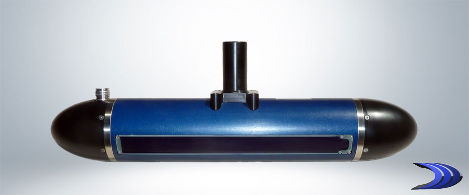
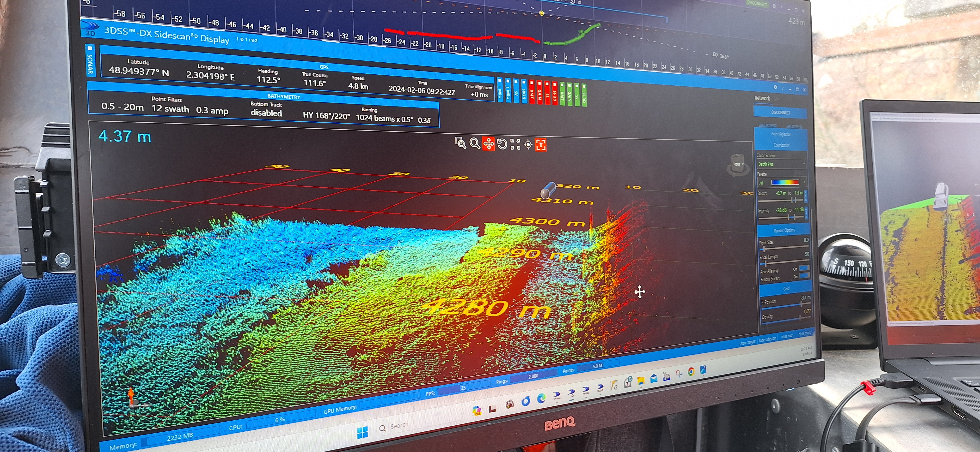
3DSS™, where bathymetry meets 3D imagery.
A ground-breaking sonar that provides extended range coherent side scan,
IHO Exclusive Order swath bathymetry, and stunning 3D point clouds.
High-resolution underwater imaging and mapping has never been easier or more affordable.

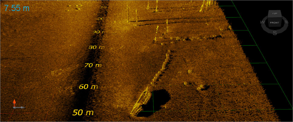
Shallow Water Mapping
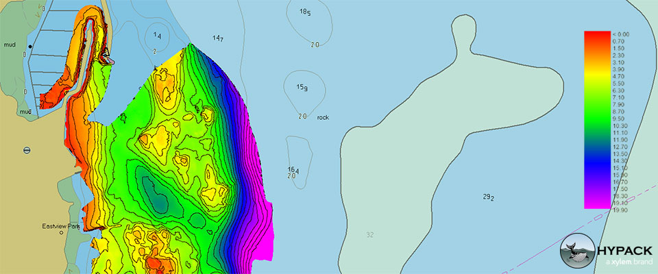
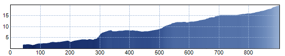
High-density IHO Exclusive Order bathymetry covering swath widths from 6 to 14 times water depth. Learn more...
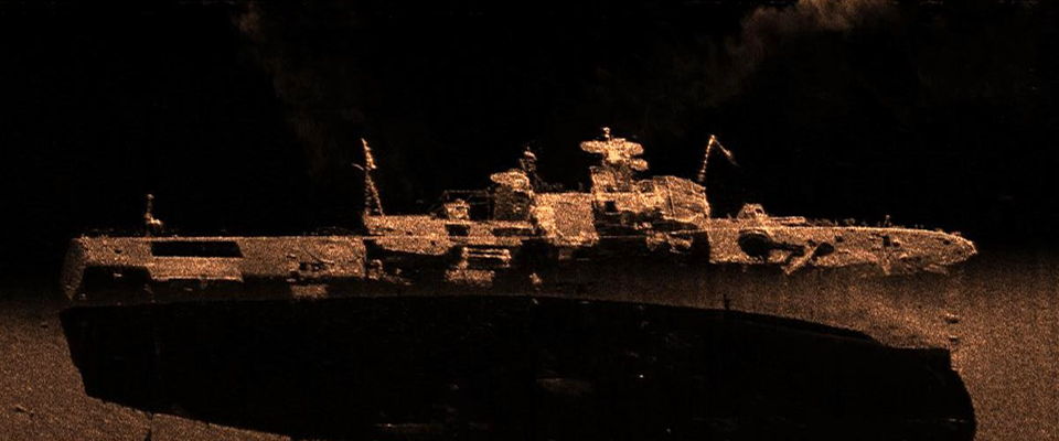
Coherent Side Scan
Standard side scan enhanced with coherent suppression of water-column and sea-surface clutter.
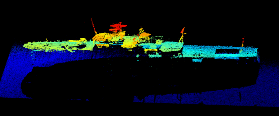
3D Side Scan
Raw 3D imagery visualized in Ping DSP's real-time point cloud software.
Third-Party Software
Fully integrated with popular third-party acquisition and post-processing software.

News
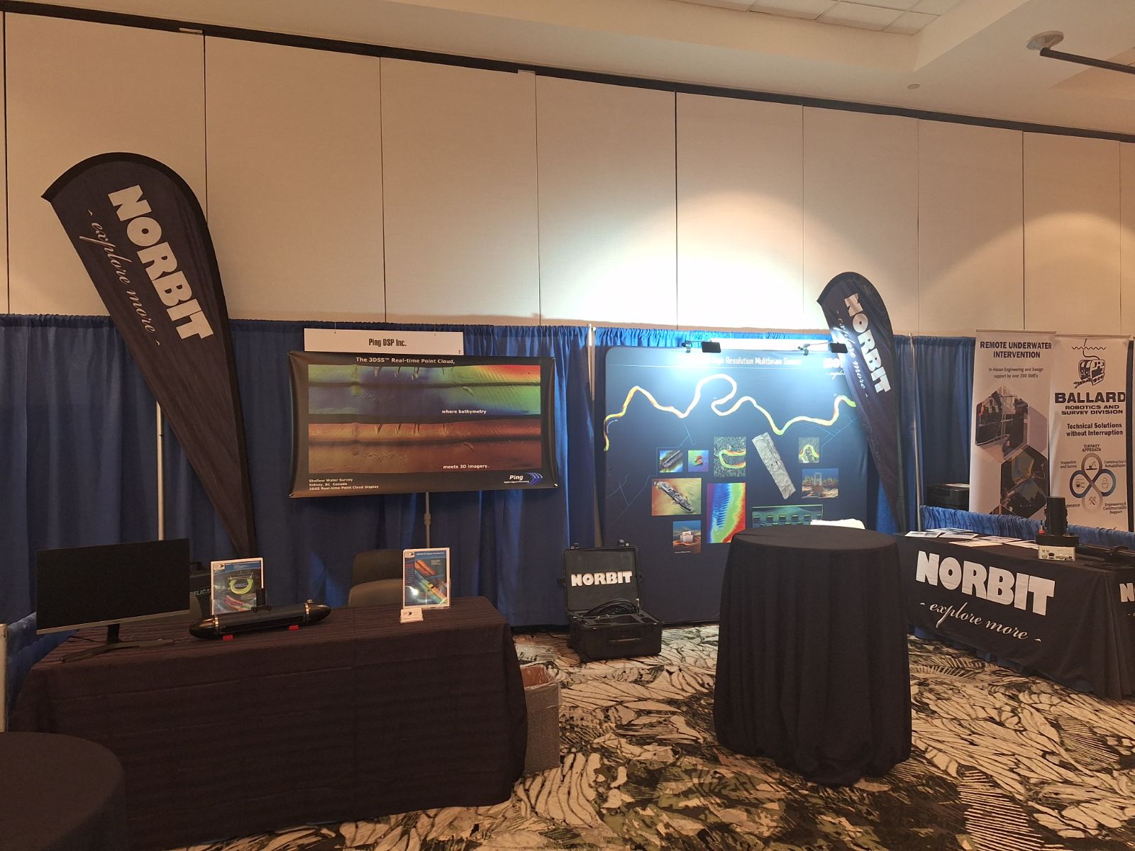
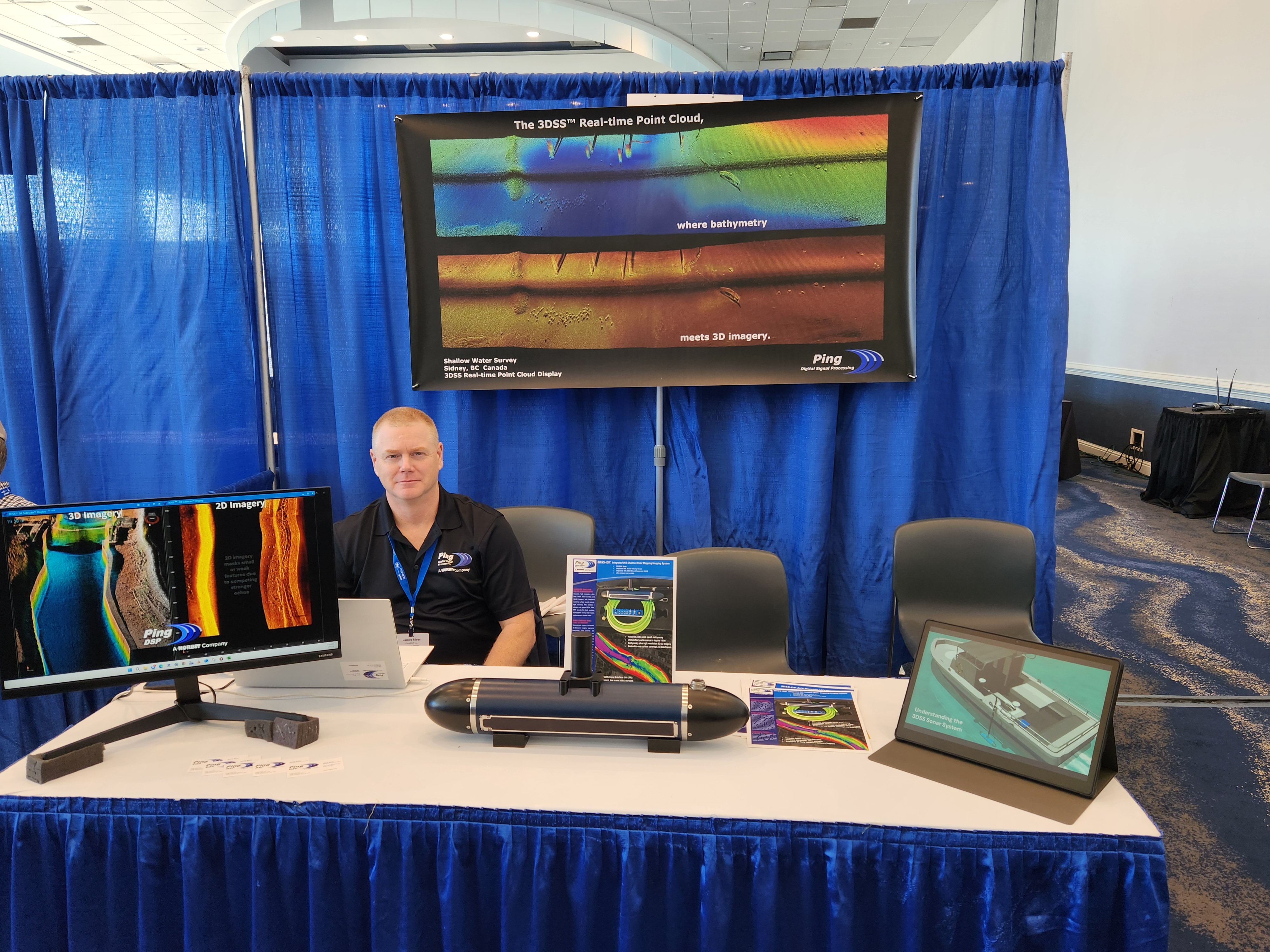
Oceans 2025 - Chicago, IL.
James was at Oceans 2025 alongside Norbit and Innomar. It was a great to see everyone who visited our booth during the event. Thank you!

Norbit Visits Ping DSP
Uni from Norbit visited the Ping DSP office to learn about operating the 3DSS. We took him out surveying around the Sidney harbour, which is always a great place for our system to shine.


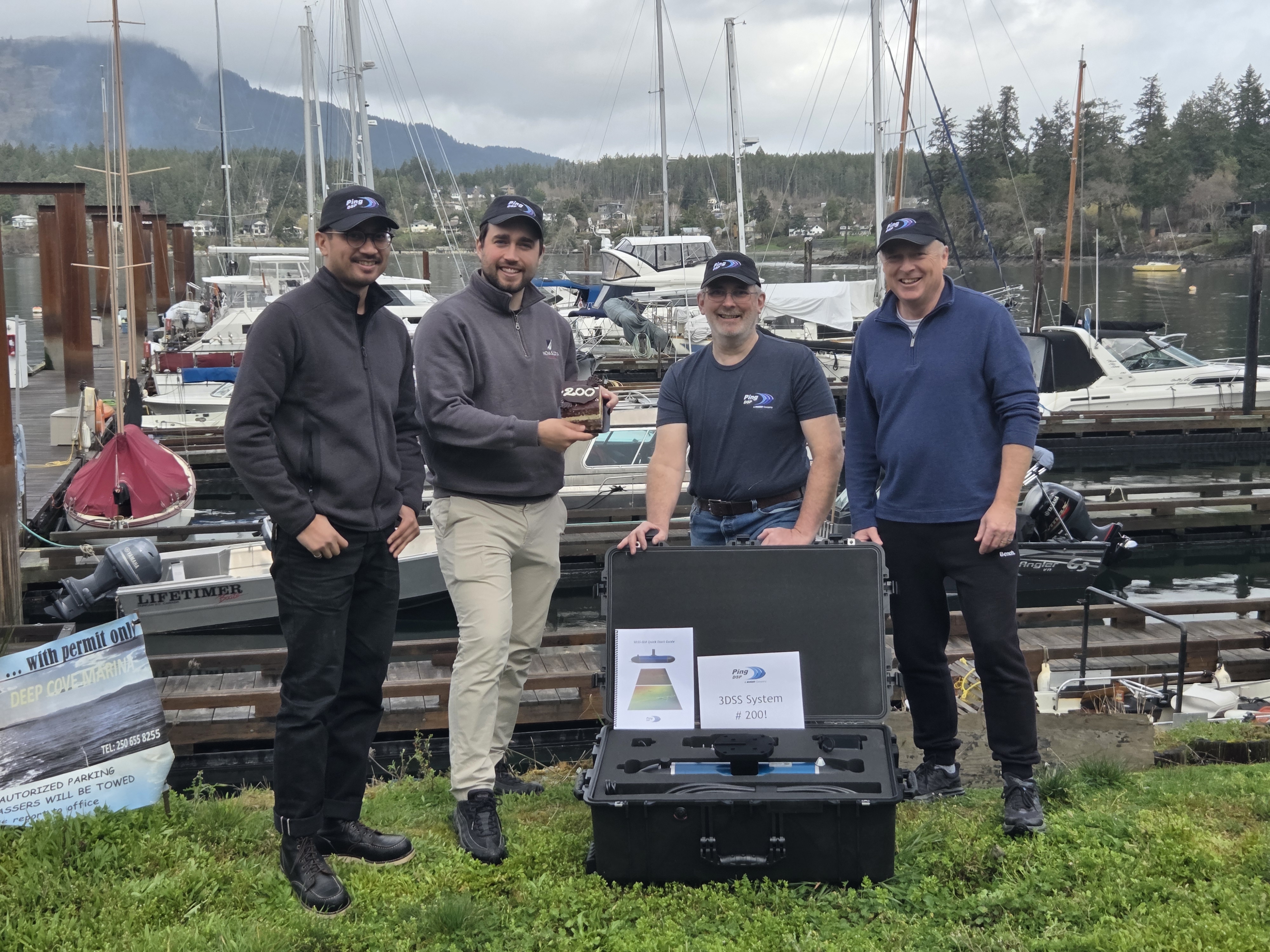
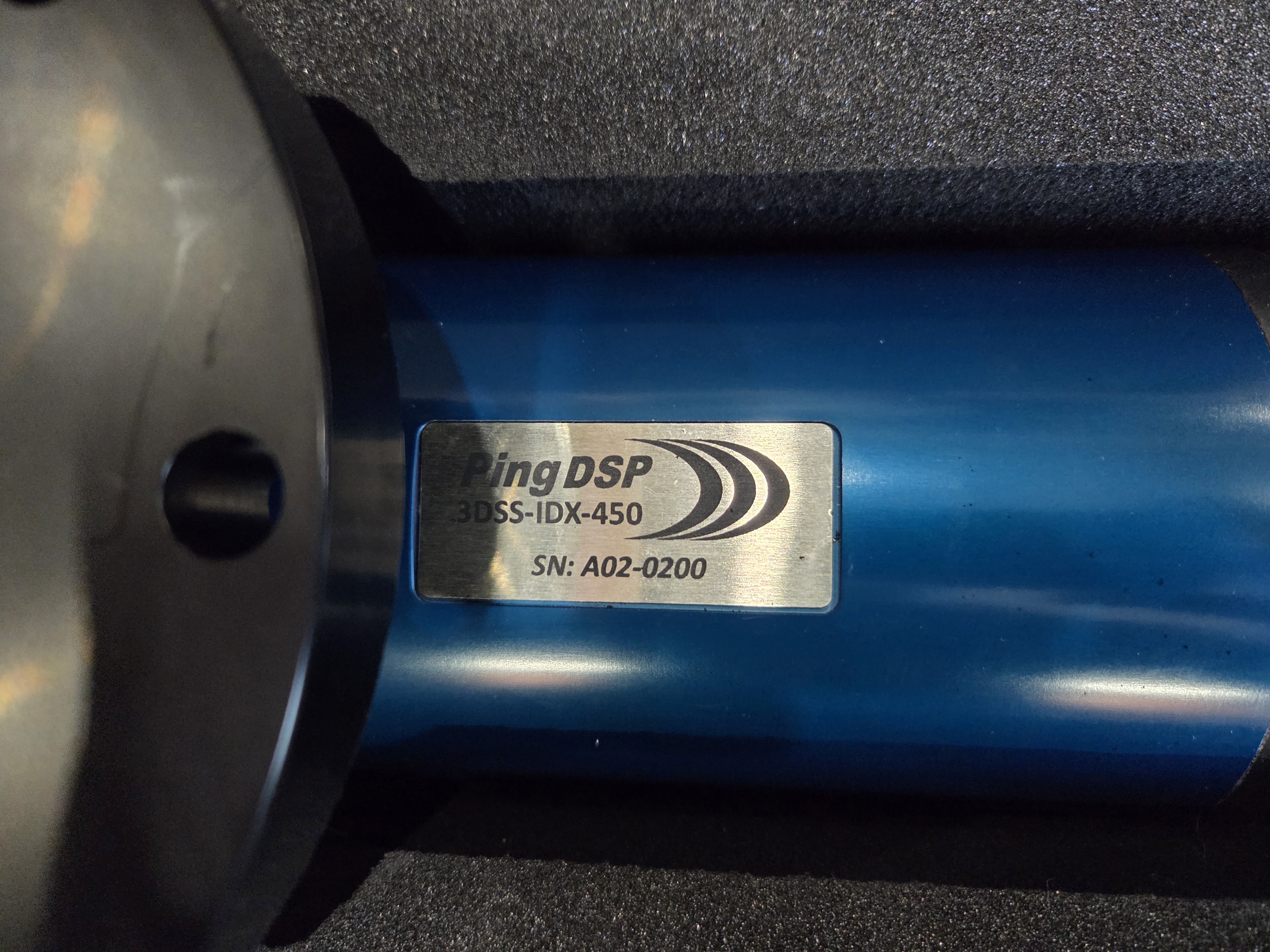
Ping DSP's 200th 3DSS Shipped!
Ping DSP shipped its 200th 3DSS sonar system! To celebrate, the team took the afternoon off, ordered a cake, and looked back on the hard work and dedication it took to get here. As we toast this momentous achievement, we look forward to our next milestone and the new innovations we have been working on.
A huge thank you to all of our customers for helping to make this happen!

Hypack 2025 - Lake Conroe, TX.
James and Torsten were at the Margaritaville Lake Resort on Lake Conroe for Hypack 2025. It was a treat to connect with so many surveyors and get them interested in the 3DSS. What an excellent way to start the year!
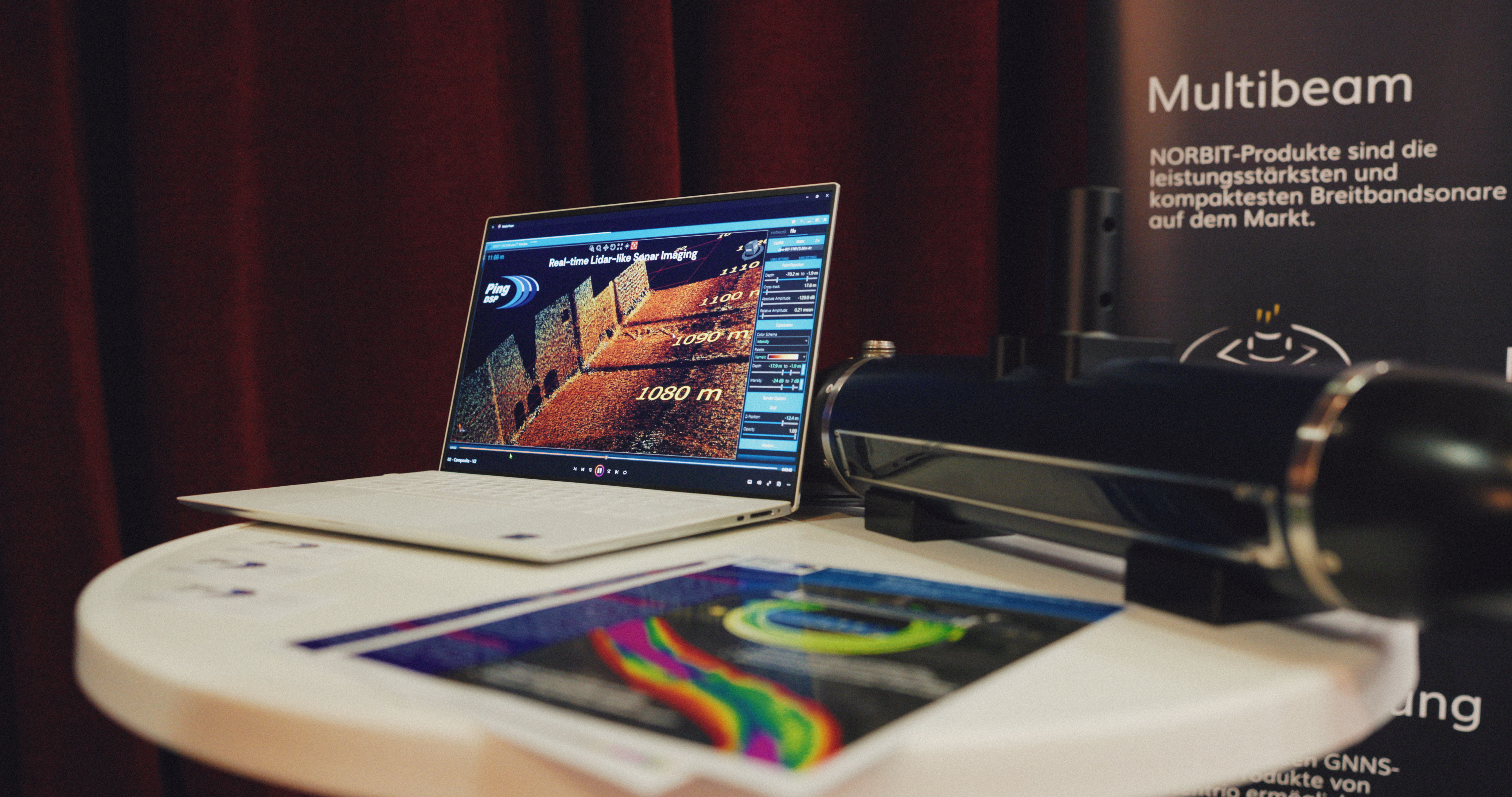
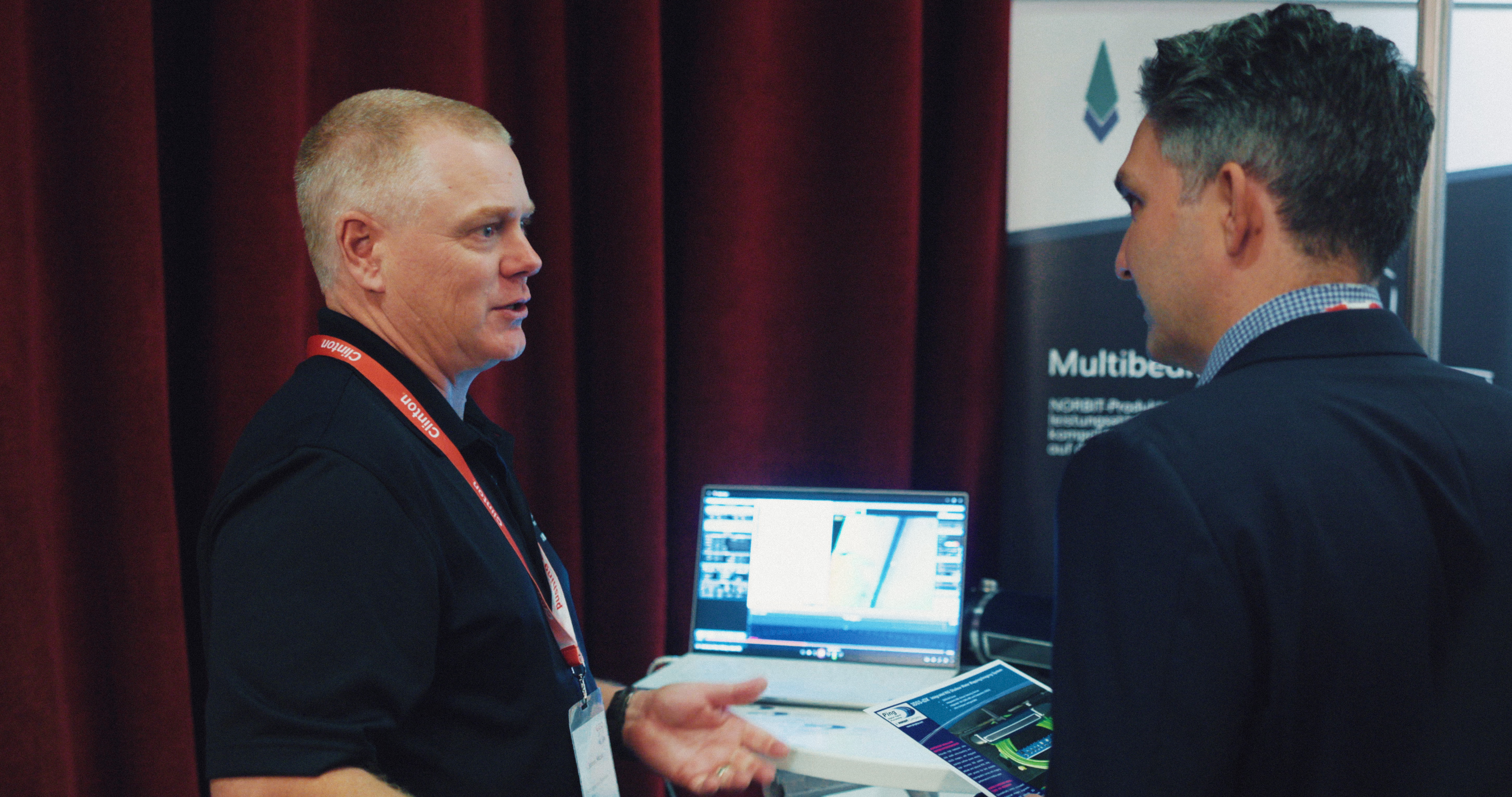
Hydro 2024 - Rostock-Warnemünde, Germany
Ping DSP once again shared a booth with Norbit Subsea at Hydro 2024. It was another great show with lots of oppotunities. Thank you to everyone who stopped by to visit!
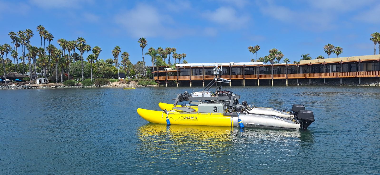
Maritime Security West 2024 - San Diego, CA
Ping DSP had the incredible opportunity to do a demo at MARSEC West alongside Norbit Subsea on the WAM-V. This multi-sensor package got some great images of the bay around Paradise Point Resort, and demonstrated the benefits of having multiple sensors working together.
Ping DSP Visits Norbit Subsea
Paul and Kurtis visited Trondheim in Norway to introduce the 3DSS to the team at Norbit Subsea. 3DSS data was collected from the Nidelva River which provided our signature 3D view of the water column and the riverbed. We look forward to many more collaborations with Norbit in the coming years.
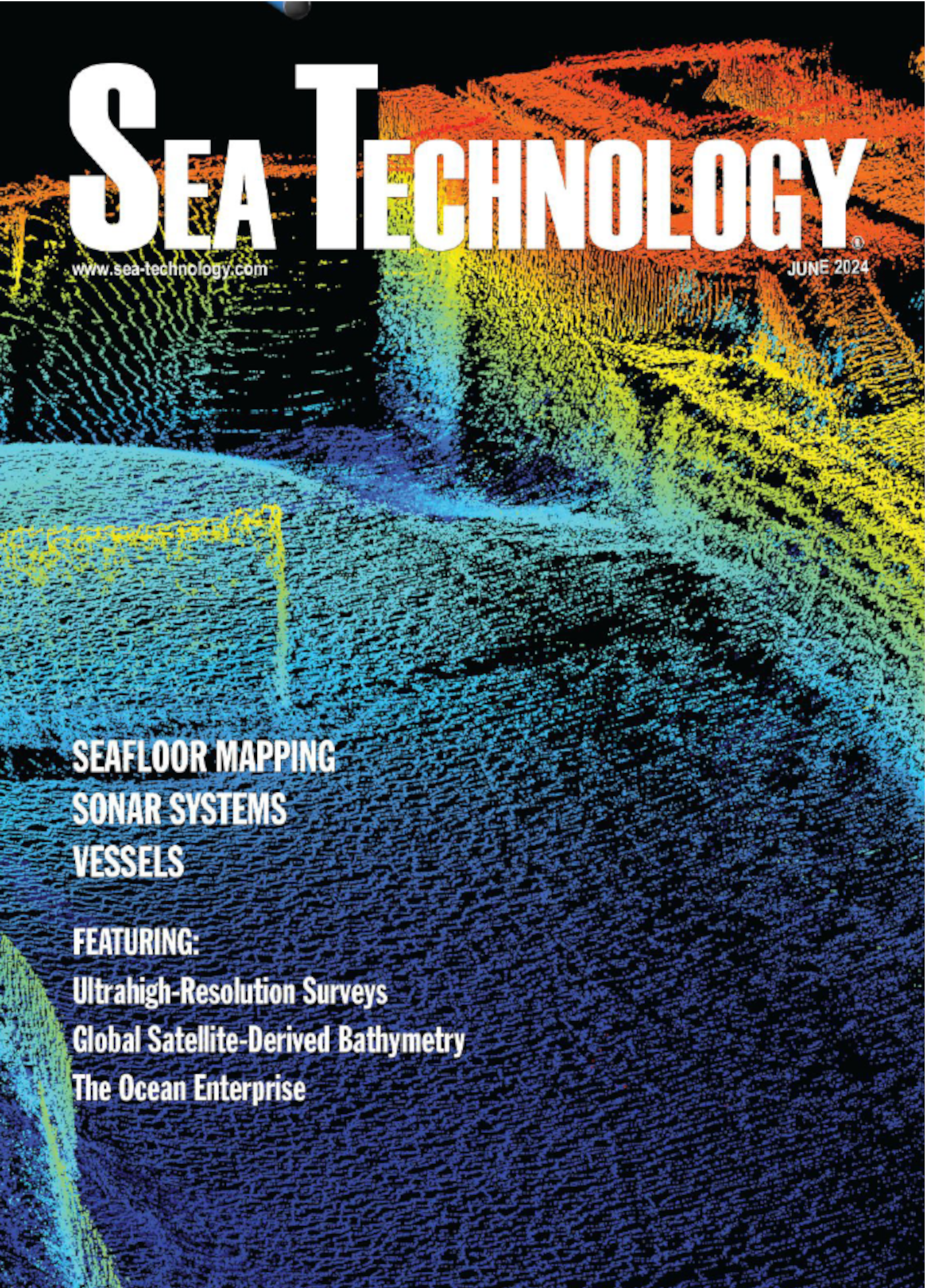
Ping DSP on the Cover of Sea Technology Magazine!
Ping DSP’s 3DSS data made it onto the cover of the June issue of Sea Technology magazine! The cover image features 3D-imagery data taken from our March 2023 virtual demo of Cascade Locks Marine Park. The 3D imagery clearly depicts the lock and other structures. Even small features, like staircases, are clearly recognizable in the data.
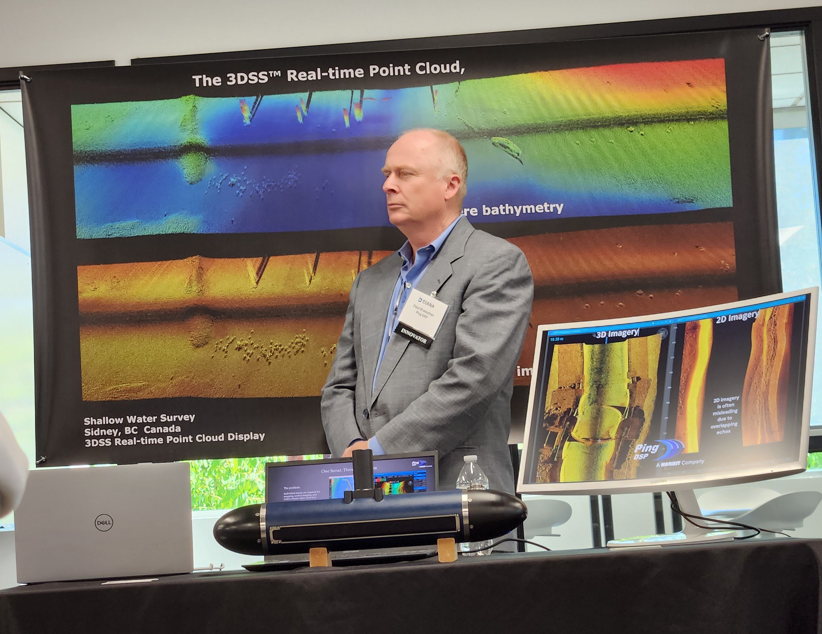
DIANA Demo Day - Seattle, WA.
NATO DIANA’s accelerator program through PNW MAC culminated in Demo Day: an opportunity for the innovation cohort companies to present their technology. The 3DSS was on display along with other amazing innovations from the cohort companies. We had the opportunity to give a short pitch, which we have been practicing throughout the program. This was followed by an opportunity for military and industry leaders to ask questions and explore the displays.
Canadian Hydrographic Conference 2024 - St. John's, NL, Canada.
We had the privilege of sharing a booth with Norbit Subsea for the Canadian Hydrographic Conference. It was great to see them and connect with many of our customers and reps.
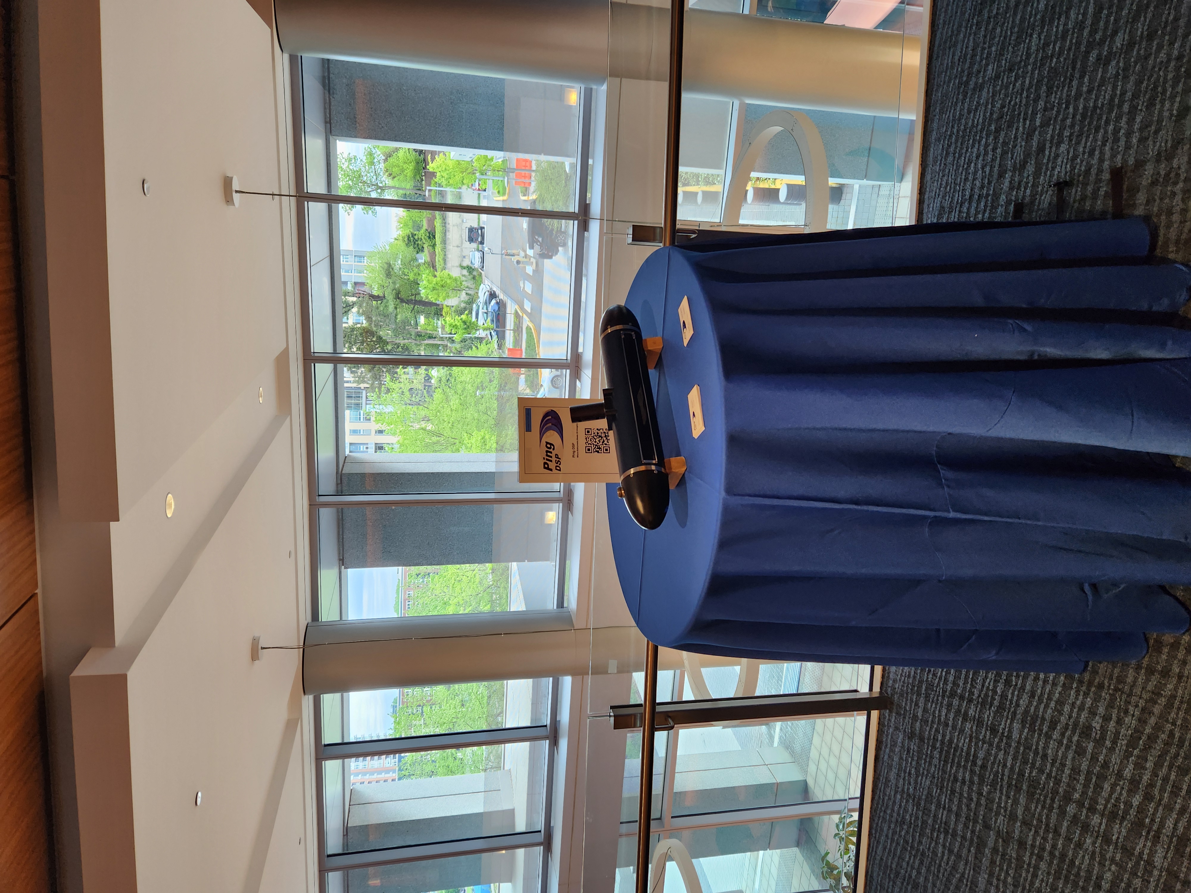
NATO DIANA Outreach Days - Washington, DC.
Ping DSP was fortunate to be able to attend NATO DIANA’s Outreach Days in Washington, DC. This event was a chance to put the 3DSS in front of military and commercial end users who would be otherwise out of reach. It was also a great chance to connect with many of the other innovators in the DIANA program. We attended a similar event in Amsterdam in the Netherlands in March of 2024, which was also very successful.

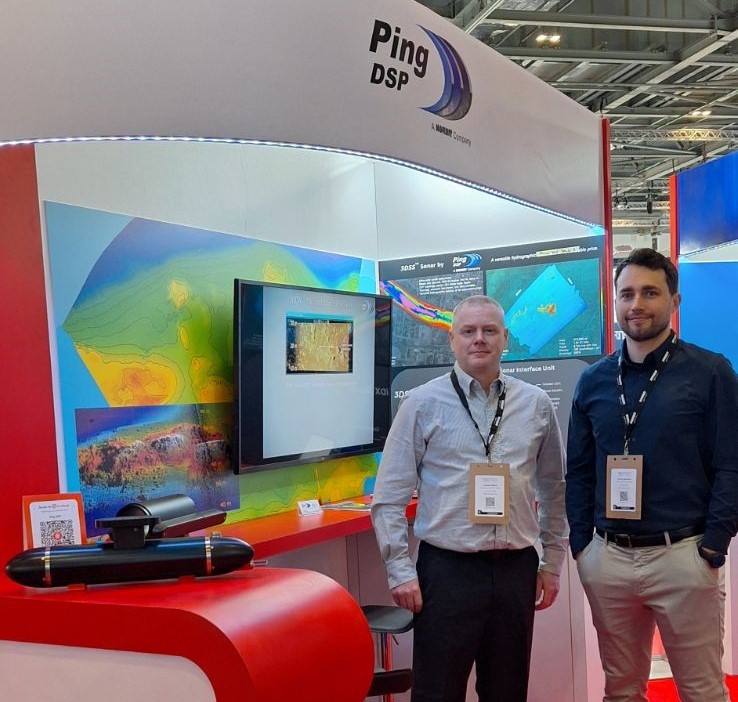
Oceanology International 2024 - London, UK.
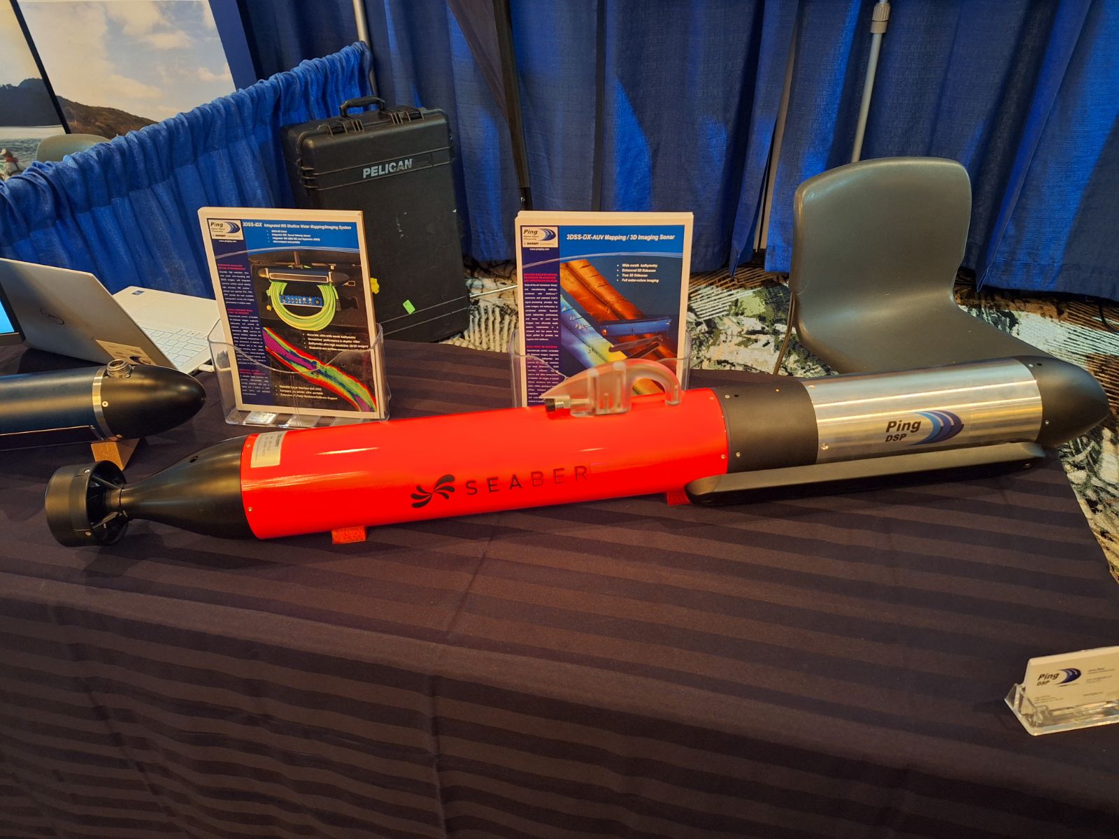
James and Kurtis had a great time at Oceanology International 2024. It was great to see many of our costumers and partners at the show. Alongside the 3DSS was our new collaboration with Seaber: a 3DSS module for their YUCO AUV. The new product is still in development, but we have hopes of announcing the launch later in 2024.
Seine River Demo - Paris, France.
With the help of NORBIT Sunsea, we had the opportunity to spend two days on the Seine River in Paris, France. We took several potential customers out to see the 3DSS in action and had a chance to do a complete survey of a portion of the river. Reach out to us if you’re interested in seeing the results!
Hypack 2024 - Savannah, Georgia.
Ping DSP was at Hypack 2024 right next to Norbit Subsea. This was the first time the two companies have exhibitioned together since Ping joined the Norbit family back in November. We were pleased to display a mockup of our new collaboration with Seaber: a YUCO USV with an integrated 3DSS. We are very excited to launch this new vehicle in the coming months!